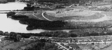
The Mountain viewed from the North after it was "razed" ca 1958. Thanks to Images of America, Framingham.
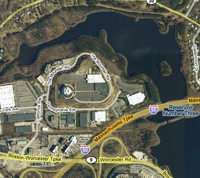
The Mountain as it is today with Bose HQ at the top. The Corporate Center is the glass building, and the R&D Center is the brown stone building. The road that goes to the top is called, what else, (the) Mountain Road. Thanks to googlemaps.
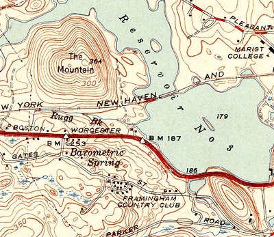
The Mountain as it was ca 1951. The Boston Worcester road is of course route 9. The little hill on the lower right is now occupied by an appartment complex. Note the Barometric Spring (we'll talk about it a little bit later). Thanks to USGS.
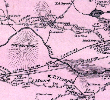
The Mountain as it was ca 1875. That was way before the Stony Brook became a suite of reservoirs. Thanks to F. W. Beers.
The Barometric Spring seen on the 1951 map picture was kind of a local attraction, it seems. All I know is that its flow depended on the barometric pressure. When the Mass Pike was built, that neat little point of interest was destroyed. All is left of the spring is water coming down the rock that was cut to make way for Mass Pike exit 12.
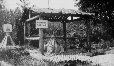
The Barometric Spring shrine. Thanks to Images of America, Framingham.
Thanks!
ReplyDeleteI just went out for a walk today and ended "up the mountain". I wondered what the history was. Your info even explains the reamins of a dirt road/track I could see along side the current road.
Cheers,
Don
I owned Thayers Express in Hopkinton for over 25 years. I believe I was the first Trucking Company to do business with Dr. Bose. I am now 80 years old, but if my memory serves me right. I believe the first time I was stopped by Bob Whitehead and asked if I went to Boston. Seems as though they were on Huron Drive in Natick at the Time. Do you know if that was true? Doug Walls
ReplyDeleteI’m going out on a limb here... there’s simply too much phenomena that points to Bose Mountain being man made. I think it came from excavation work of all those stone house dams that turned the Sudbury River into a series of sequential reservoirs.
ReplyDelete